
You can see on the bottom right side the channel the military blasted through to provide access to the lagoons. The military also put in an airstrip which is slightly left from the center of the photograph. The airstrip is on Cooper Island. This is the largest island and the location of the research station.
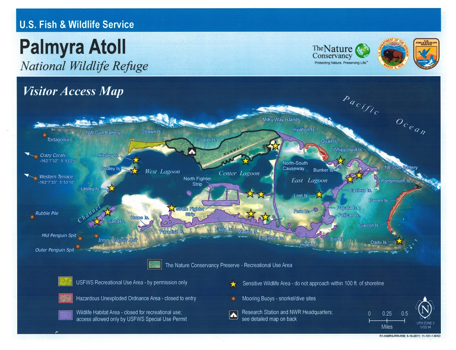
Next are two maps from USFWS:

Finally, I found a map of the research station buildings:

You can click on any one of these maps to get a larger view.
No comments:
Post a Comment