The photos below are from a web site titled "Abandoned & Little-Known Airfields: Western Pacific Islands". The section on Palmyra Atoll is the second entry, so you have to scroll down. There you will find a dozen photos and maps of the airstrip. Be sure to click on the images to view them full-size.
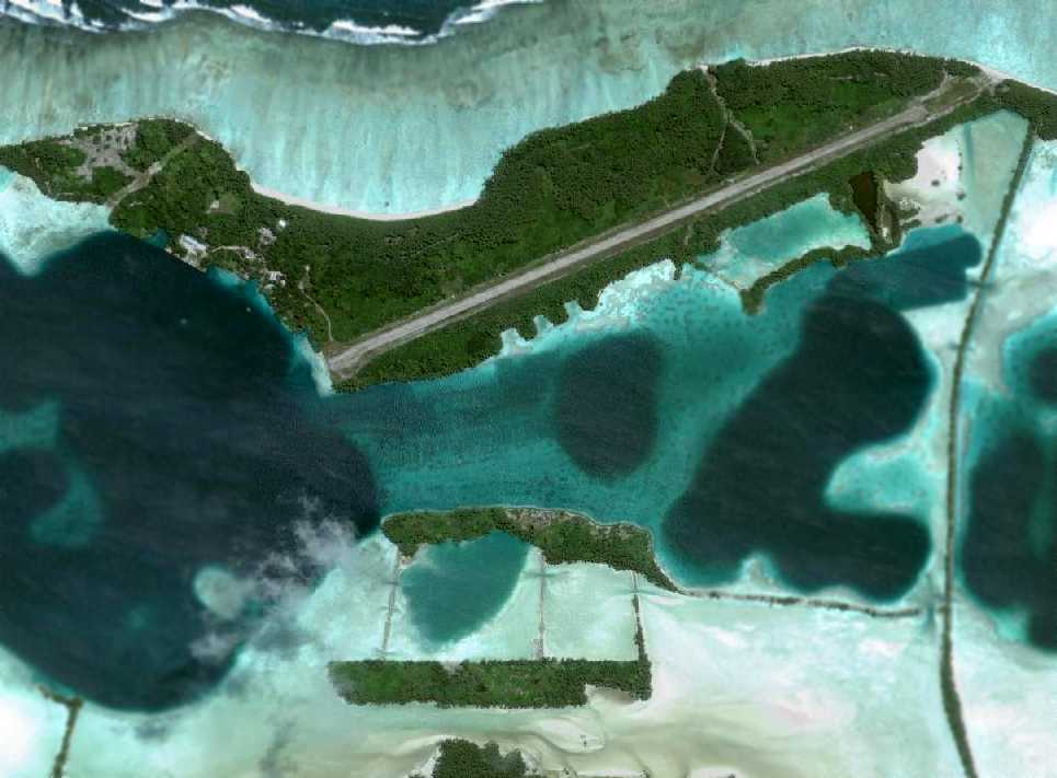
An August 1, 2005 aerial view of Palmyra showed the single remaining runway on Cooper Island.
Only a small northwest portion of the northwest/southeast runway remained recognizable.

An August 1, 2005 aerial view looking northeast along the single remaining runway on Cooper Island.

An undated (1980-2009) photo of the remains of Lodestar N163R off the southwest end of the Palmyra runway.
It is a good thing the atoll was long enough for a runway. It looks as though it runs the entire length of the atoll and from what I remember from an earlier post showing a plane taking off, every bit of the runway is needed.
ReplyDeleteMary
I met a vet, US Navy, today, that was stranded on this island, with nine other men, during WWII. The story that he told me was amazing.
ReplyDelete